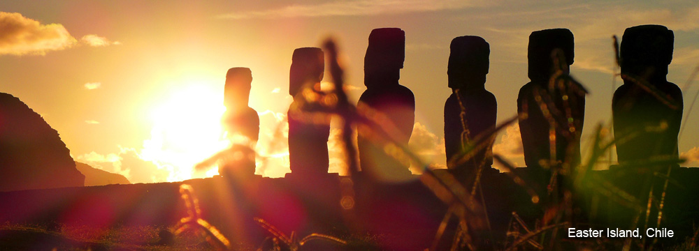
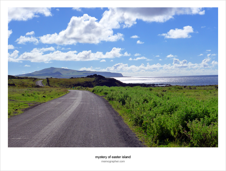
The opening post of my photo-trilogy “Rapa Nui- The Island. The People. The Museum”.
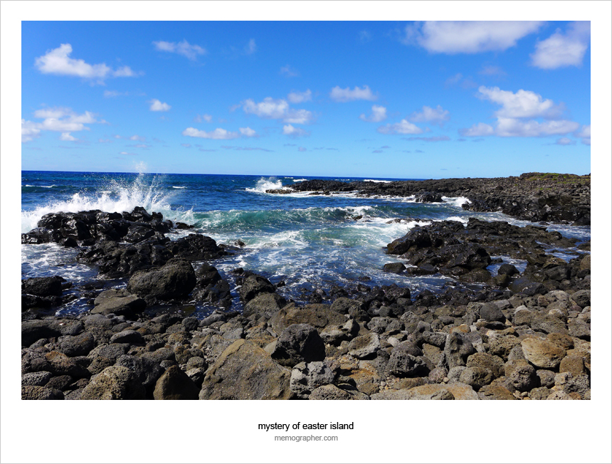
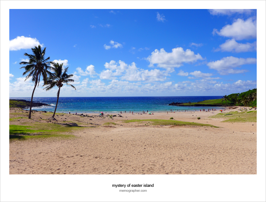
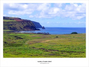
Rapa Nui is the island in the southeastern Pacific Ocean (also known as Easter Island), It’s just 14 miles (22.5 km) long and 7 miles (11.3 km) wide and is one of the most remote inhabited islands in the world. The nearest continental point lies in central Chile, at 3,512 kilometers (2,182 mi) away.
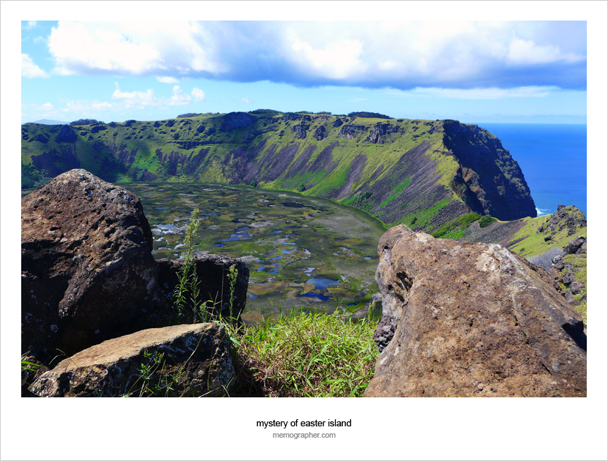
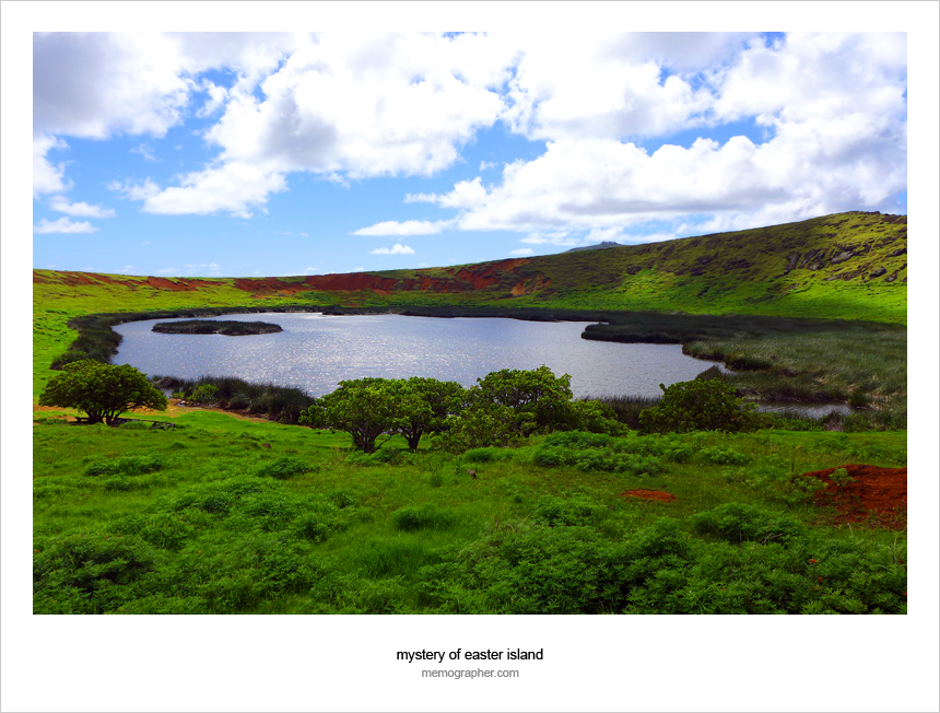
Rapa Nui is consisting mainly of three volcanoes: Terevaka (altitude 507 meters) forms the bulk of the island, while two other volcanoes, Poike and Rano Kau, form the eastern and southern headlands and give the island its roughly triangular shape. Rapa Nui and surrounding islets such as Motu Nui and Motu Iti form the summit of a large volcanic mountain rising over 2,000 meters (6,600 ft) from the sea bed. In the first half of the 20th century, steam reportedly came out of the Rano Kau crater wall. According to geologists the last volcanic activity on the island occurred 10,000 years ago.
Click on image to view full size.
Rapa Nui – The Island
Rapa Nui – The Island
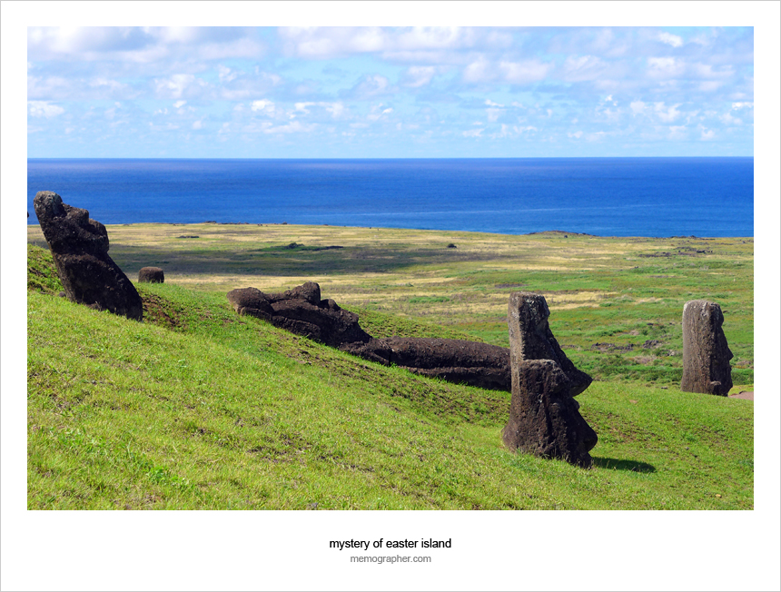
Rapa Nui – The Island
Rapa Nui – The Island
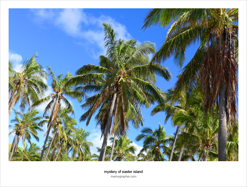
Rapa Nui – The Island

Rapa Nui – The Island

Rapa Nui – The Island
Rapa Nui – The Island
Rapa Nui – The Island
Rapa Nui – The Island
Rapa Nui – The Island
Rapa Nui – The Island
Rapa Nui – The Island
Rapa Nui – The Island


omg the 6th photo!!!! omg !!! the blues stand out so well in your photography. any tips on how to get these myself alex? Gosh you inspire me to stirve to your level. :)
natasha recently posted..The Mannequins of Bangkok
Thanks, Natasha :) the “blues” depend on many factors… the angle you shot water surface, the sky above, photo gear used, including lens, filters, and camera settings, file format you save, software used for post-processing, and viewer’s monitor :) may be a few more things… where do I start on the tips? —
Deep water, clear sky, and “vivid colors” settings ;)
memographer recently posted..Photo Trilogy: Rapa Nui – The Island. The People. The Museum
Wow, this reminds me of Okinawa in Japan.
I love the landscape there. I’m sure it’s worth visiting.
Never ever considered going there until I read your blog post! :)
Thanks, Jasmine! I’ll be the happiest man on the Earth if my photos can make you go there :)
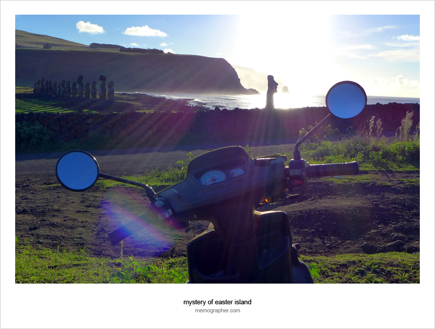
Love these shots especially the one of the status. I didn’t realise how ‘in the middle of nowhere’ they are located. We still haven’t made it to Easter Island yet but we’d love to someday.
jill recently posted..Ontario, Where the Wild Things Are
Thanks for dropping by, Jill! Yes, definitely, you should make it to Rapa Nui someday. Here are links to more pics of statues ;)
http://memographer.com/2013/06/easter-island-my-new-friends-moai/
http://memographer.com/2013/04/mystery-of-easter-island/
Stunning photos. I am surprised how green Rapa Nui is. I read somewhere that the vegetation is slowly but surely dying out and what used to be green is becoming more and more barren and brown. This is looking quite lush though.
TammyOnTheMove recently posted..Stormy celebrations in Sihanoukville
Thanks, Tammy. Certainly, the Earth was greener 100 years ago. And the change should become more noticeable on such a small piece of land. I have never been to Rapa Nui before. So, I can’t compare. I have not noticed that “vegetation is dying out”. I was there in March (their end of summer). Rapa Nui was MUCH greener than Atlanta would be in August-September :)
I have never ever seen water so blue! I want to visit here, now!!!
Jess @UsedYorkCity recently posted..5 Free Things To Do In London, England
Deep water, clear sky, and “vivid colors” settings ;)
memographer recently posted..Photo Trilogy: Rapa Nui – The Island. The People. The Museum
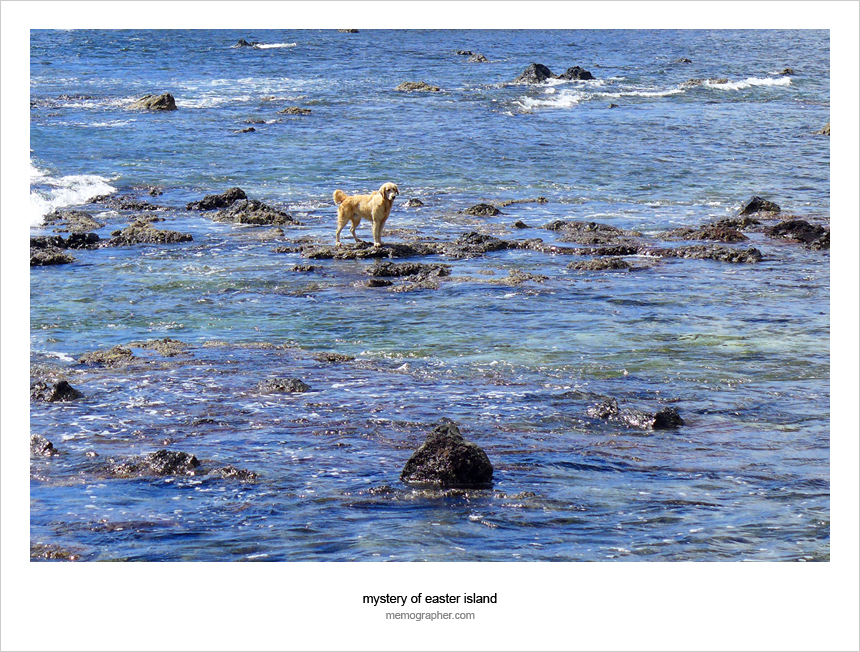
Nice snap of the pup! I loved the dogs there. I didn’t care how flea-infested they may have been. They were so friendly and sweet and just in need of a bit of lovin’.
Colleen Brynn recently posted..Beautiful To Meet You
This guy was walking on the water 24/7 :)
Yes, pups around the Globe are in need of a bit of lovin’… as we all are.
Memographer recently posted..Cambodia. Siem Reap. Floating Villages
Sensory overload in the best way – just can’t stop looking at these photos. Each one has such detail and meaning. what a wonderful treat and great way to start my day. Thanks memo!
Maria recently posted..Wordless Wednesday – Ingredients
Thank you, Maria! It’s all Easter Island’s fault :)
Memographer recently posted..Panoramas of South America
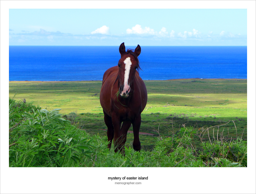
You always take the best pictures. I especially love the picture of the horse! I hope to visit Easter Island someday – it looks so gorgeous and serene.
Dana Carmel @ Time Travel Plans recently posted..Where to Stay in Paraty: Eliconial Paraty Pousada
Thank you, Dana! I like that shot too. It’s a “wild” horse feeding itself almost at the top of volcano Rano Raraku. As I’ve been told, the horses are kept around Rapa Nui island for decoration purposes.
Memographer recently posted..Easter Island: My New Friends Moai
Beautiful landscape and views of such a mysterious place. Love the photos!
Salika Jay recently posted..Why You Should Take An Alaska Cruise
Thank you, Salika! Glad you love these!
Memographer recently posted..My Travel Transporters: Airplanes
Simply breathtaking work and images, Alex. Every image is inviting me visit Easter island soon.
Marisol@TravelingSolemates recently posted..Dominica: The Hike to the Boiling Lake
Thank you, Marisol! Hope you will go there soon.
Memographer recently posted..Panoramas of South America
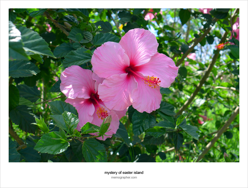
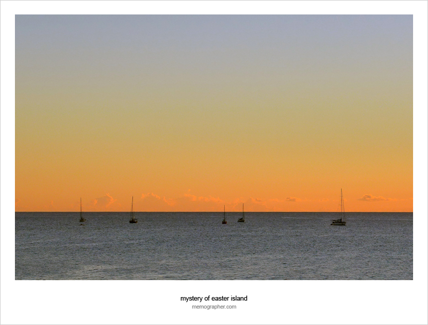
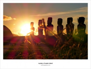
A beautiful series, Alex. I particularly like the crater, Moai statues in the distance, the flower, and the wonderful minimalism of the orange toned sunset.
Andrew Graeme Gould recently posted..Valparaíso, Chile: More from Cerro Alegre
Thank you, Andrew!
You have been in so many places that it’s hard to decide where to start reading your blog!
I started with Easter Island – Rapa Nui. This island first fascinated me years ago when I started to grow my interest into the religious/filosophical mysteries of the world, I hope to get there myself one day and ask my questions to the giant men! :)
a Blonde around the World recently posted..FROM LAS VEGAS TO LOS ANGELES
Thanks for stopping by, Blonde! Easter Island is a good starting point here. The island is a mystery! I loved every minute of my trip. Definitely, it worse to go and talk to the giant men [wink]
Memographer recently posted..Delta Air Lines Logos – Magazine Ads From 1960’s
Lovely photos, Alex!
We invite you to participate in the next edition of our Travel Photography competition. Every week we publish 3 winning shots on our website and write a nice bio with a link to the photographers’ websites/FB/Flickr pages.
Find more details here: http://hitchhikershandbook.com/your-contributions/travel-photography/
Happy travels!
Hitch-Hikers Handbook recently posted..Why visit Madrid, Spain?
Ania/Jon, glad you like these. Thanks for the invite! I will definitely participate.
Happy travels to you too!
Memographer recently posted..Untitled Captures From Trip to Rome, Italy
Gorgeous place. Looks like it has a lot to offer–public beach, hike to crater, the mysterious heads. What was your favorite part?
Emily recently posted..Ten Fun & Cheap Things To Do with Kids in Granada
Yes, Easter Island is gorgeous, Emily. I really enjoyed riding a bike around the island and hiking. The heads ad mystery to the trip.
Memographer recently posted..My Orange Crush – Spring Break on Tybee Island